Recent News Articles

Recording Longitudes and Latitudes

15 Mar 2022 2:14 PM | Anonymous

Genealogists have always been taught to record our sources of information. We not only record the name of the book or other source of genealogy information, but we also record the location of the building (repository) where we found it. Typically we record the building’s name, street address, city and state.

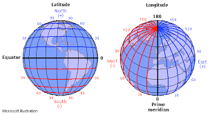
With today’s technology, shouldn’t we also be recording the geographic coordinates? With GPS receivers and the plethora of high-quality on-line maps, it is now easy to find the exact latitude and longitude of any address. Unlike street names, the longitude and latitude will never change.

I have written about finding cemeteries and other locations of genealogical interest by using GPS receivers. Shouldn’t we be recording the exact latitude and longitudes of those cemeteries into our genealogy databases? Perhaps the cemetery’s location alone isn’t enough. Should we record the exact location of the ancestor's tombstone.

How about the location of great-great-grandfather’s farm? I believe the latitude and longitude of that farm would be a valuable entry in your database so that future genealogists who have access to your data can find that farm’s location, even if it has since become covered with weeds or perhaps become a high-rise apartment building. In short, I think we should record the geographic coordinates of every location in our genealogy databases.

You can enter the latitude and longitude of any location as a text note into most any modern genealogy program. However, several of the better genealogy programs have specific database fields for these coordinates.

If you own a GPS receiver, the next time you visit an ancestral site of any sort, you should record its geographic coordinates into your database. You can also find similar information by consulting topographic maps.


Comments

  • 16 Mar 2022 6:32 AM | Anonymous
    I will try to be brief, but this raises a swag of issues.
    1) I have been trying to record lat & long of family items for more than 5-years. Q1 what is the purpose of your database? I want to record a lot of info before older members of the family die and their knowledge is lost. I want to record it in formats easy to pass down the generations (that means digital formats that can easily be duplicated, passed on, and converted into new technologies Q2) what accuracy do you need? For a building ~5m, for a grave (which can easily get lost) ~1m
    Comment: medium priced phones have accuracies of 3 to 10m, depending on a swag of factors, i.e. not bad for buildings, particularly if you design your measurement methods properly eg cross check to nearby survey points. Lots of phones these days read the Galileo GNSS constellation. I have recently looked into this - the Galileo low-precision option that is open to the public claims 1m accuracy, but I suspect that most phones and other consumer priced gadgets can't achieve this - still a subject under investigation. Australia will be commissioning the SBAS/PPP system in the near future, that might be an alternative, and other countries maybe doing similar things.
    Q3) If your observations are designed for use long into the future, have you thought about continental drift? At ~6cm per annum, Australia is one of the fastest moving tectonic plates on our planet. In 2120 that grave will be 6m from where you measured it. I don't know whether future devices will automatically correct for this, but more importantly you must record an approx date of measurement, in addition to lat & long. I don't know any genealogy software that has a field in their database for this, most just use a comments field.
    Link  •  Reply
  • 16 Mar 2022 8:00 AM | Anonymous
    Wow. 6 cm per year doesn't faze me. Even 3 to 10m is a better record than "just north of East Bugbrains, Idaho." A more-practical Eastman-style next step would help. My elderly brains still think of wording like 84 degrees, 12 minutes, 23.577 seconds East Longitude.... And, how do I make my Android (or, for others, iPhone) cough up the goods?
    Link  •  Reply
    • 17 Mar 2022 6:47 AM | Anonymous
      One of many subjects I didn't discuss (I didn't have time to post a book length article) was formats for lat & long. We have all grown up with the format you mention, but I find arithmetic is simpler if you use decimal degrees, at least once you master them. You can easily fond web-sites that convert between the various formats, also ones that calculate distances and bearings between 2 points, etc.
      For starters, remember 1º of lat is roughly 110Km, and same goes for 1º of long on the equator. At the poles 1º of lat is still ~110Km, but 1º of long is 0 m. So 0.00001º of lat is about 1.1 metres.
      Link  •  Reply
  • 16 Mar 2022 9:37 PM | Anonymous
    I used to use a GPS finder. However, the easier way to get this info now is to use your smart phone. Download the app for findagrave. Take a photo. Add it to findagrave, and the coordinates will appear on the site for the grave! We have been using it to access veteran graves in a large cemetery for Wreaths Across America.
    ps, You must do it through their app.
    Link  •  Reply

Eastman's Online Genealogy Newsletter


Powered by Wild Apricot Membership Software