The thought of your ancestors of 100 or 200 years ago traveling along a modern-day interstate highway may seem amusing as interstate highways didn’t exist until the 1950s. Yet, it is quite possible that your ancestors traveled along the same routes as today’s interstates, plus or minus a very few miles.
Westward migration in the United States usually took place in the path of least resistance: on riverboats where practical or on pathways along rivers when boat travel was not available. In cases where there was no river to follow, overland travel generally went along the path of least resistance, too: through valleys, through mountain passes, and perhaps straight across the flatlands and prairies.
When studying migration patterns throughout history in the United States, we can see hundreds of examples. In New England, the first inland areas to be settled were along the Merrimack River, the Connecticut River, the Penobscot River, and the others.
When researching the origins of those who settled the mountainous areas of northern Vermont and New Hampshire, we find that most of them were from Connecticut and western Massachusetts. They traveled up the Connecticut River, not overland across the north-south mountain ranges that receding glaciers carved many thousands of years earlier. Today, Interstate 91 follows roughly the same route.
In Massachusetts, the east-west migration generally followed the valleys through the central part of the state, often following the Boston Post Road (present-day U.S. Route 20). That path is more or less parallel to the present-day Massachusetts Turnpike, or Interstate 90.
As we travel down the eastern seaboard, the migration pattern was repeated: the Hudson River, the Susquehanna River, the Potomac River, the Savannah River, and many others became “highways” of travel for our ancestors. As we move further west, we find the “super highways” of years past: the Mississippi River, the Ohio, and the Missouri.
Of course, rivers didn’t always exist in convenient places. Many times the early settlers blazed overland routes through valleys where travel would be easier for wagons drawn by horses or oxen. Two major examples would the Cumberland Gap in Tennessee and the Wilderness Road in Virginia. These routes did follow rivers, where possible, but they also went overland through valleys, following paths that could be used by horses and oxen pulling wagons. Of course, there were dozens of other highways.
If you follow the migration paths of your ancestors prior to 1850, you will see that they usually traveled along the same routes as did earlier travelers, routes that allowed for easier transport. These routes were generally on rivers, beside rivers, or through valleys.
For a few years in the first half of the 19th century, canals looked like they would become the primary method of transportation. Indeed, that did happen in a few areas, such as the Erie Canal. The traffic on the canals moved at two or three miles an hour as the barges and boats were typically powered by work animals that walked along adjacent footpaths. However, canals were doomed almost from the start as a new, mechanized beast soon appeared that could move more goods, move them faster, and do so at less construction expense.
By the mid 19th century, railroads started appearing in significant numbers. Railroad locomotives could perform the work of many horses or oxen, and the travel experience for passengers in railroad cars was much better than riding on a buckboard or a Conestoga wagon. These “iron horses” were very powerful but had one major shortcoming: they weren’t very good at climbing hills.
The railroads were always built along the flattest land possible, often on or beside the routes that had already been established for overland travel. The railroads thrived best along riverbanks, which rarely had hills, or through valleys, including the Cumberland Gap and the Wilderness Road. More than a few railroads were built on the footpaths beside canals, replacing the “beasts of burdens” that had powered the canal boats of the previous generation. Of course, these new-fangled railroads transported immigrants, freight, and livestock alike.
Let’s fast forward another century. In the 1950s, the federal government began its interstate highways project. The primary justification was to build a transportation system the Defense Department could use to move convoys in time of war. However, commercial and personal uses soon eclipsed defense purposes. Today we all travel along interstate highways without regard to the travel hardships of our ancestors.
The interstate highways often follow the same paths as the earlier railroads and the still earlier ox-carts and covered wagons. While modern construction techniques have allowed a few exceptions, such as building highways in the mountains, the majority of today’s interstate highways are built along traditional trade routes and migration paths. In other words, today’s highways often follow rivers, old canals, and deep valleys.
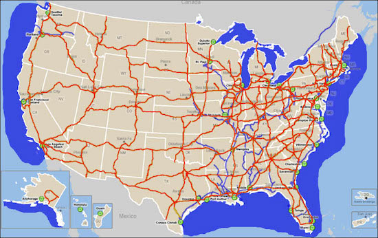
Are you mystified as to the origins of some family in your family tree? You know where they lived on a certain date but wonder where they came from? Get out a modern-day highway map, and find the town where those ancestors lived. Next, see where the major highways of that town go. Chances are that your ancestors traveled along one of those routes. They almost never traveled over a mountain range or through a swampy area.
There’s a good chance that your ancestors followed the same approximate route as today’s super highways. Start by looking at the records of the state “up the highway” from their hometown. Sleuthing along today’s interstates may actually pay off.